Search


Bluetooth AoA Software Functions
High-precision location data that delivers real-time operational visibility across your entire site.
-
 Real-Time Location Mapping
-
Trajectory Playback & Analysis
-
Organization & Device Management
-
Role-Based Access Control (RBAC)
-
Geofence & Alarm Management
Basic Location Services
The core toolkit built directly on the engine — trajectory display, asset management, full-area maps, and geofencing.

Target Quick Search and Follow-up Positioning
Instantly locate any person or asset and keep the map centered as they move.
Dynamic Battery Monitoring with Low-battery Reminders
See each tag's battery level at a glance and get alerts before it runs out.

Tree-structured Visualization Aligned with Your Org Hierarchy
Browse people and assets by department, site, or team the way your business is organized.
Multiple Tracker Issue and Return Modes
Assign and reclaim tags with flexible workflows that fit different scenarios.

Multi-scenario Maps in TIFF/DXF/PNG/FBX/SHP
Import existing floor plans and site drawings in the formats you already use.
One-click Switching Between 2D and 3D Views
Move between a flat overview and a spatial 3D model without leaving the map.

Custom Area Drawing for Complex Spaces
Draw precise zones around restricted, high-value, or hazardous areas.
Configurable Entry/Exit Alerts with Allow and Block Controls
Trigger alarms on the events that matter and set who is permitted in each zone.

Value-Added Applications
A selection of our most-deployed value-add modules. Swap in production screenshots as they are captured.
Multi-tag Speed-up Playback with One-click Full Trajectory
Review several tags at once at adjustable speeds, or jump straight to a complete path.
Backtracking Supported within One Year
Investigate incidents and reconstruct events from up to twelve months of history.

Cameras Auto-switch to Follow Personnel's Location
The nearest camera feed comes up automatically as a person moves through the site.
Historical Trajectories with Synchronized Video
Play back a path alongside the matching footage for full visual context.

Custom Viewing Range and Time Period for Accurate Analysis
Focus the heatmap on the exact area and timeframe you want to understand.
View by Personnel or by Area
Switch between who is spending time where and which spaces are busiest.

Handles Multi-shift and Cross-day Attendance
Track complex schedules including overnight shifts without manual adjustments.
Traceable Records for More Accurate Results
Every attendance entry is backed by real location data you can audit.

Mobile Applications
Powered by real-time positioning, our mobile apps enable seamless navigation and smart operational management on the move.
High-Precision Location Tracking
Real-time positioning of staff, vehicles, and materials, straight from your phone.

Mobile App Smart Navigation
Turn-by-turn indoor navigation with multi-floor routing and venue maps.



See the engine and the full software suite running on live data. Request a demo kit or talk to our team about deploying Blueiot RTLS in your facility.

 WebSocket
 JavaScript
 HTTP
HTTP
Anchor + Tags + Software = Full RTLS
Blueiot tags are one part of a complete real-time location system. Pair them with our anchors and positioning engine to unlock full-stack indoor tracking and geofencing.

AoA Anchors
Wearable badges and asset tags for tracking people and equipment inside warehouses, hospitals, and factories.
Learn More
Location Tags
Wearable badges and asset tags for tracking people and equipment inside warehouses, hospitals, and factories.
Learn More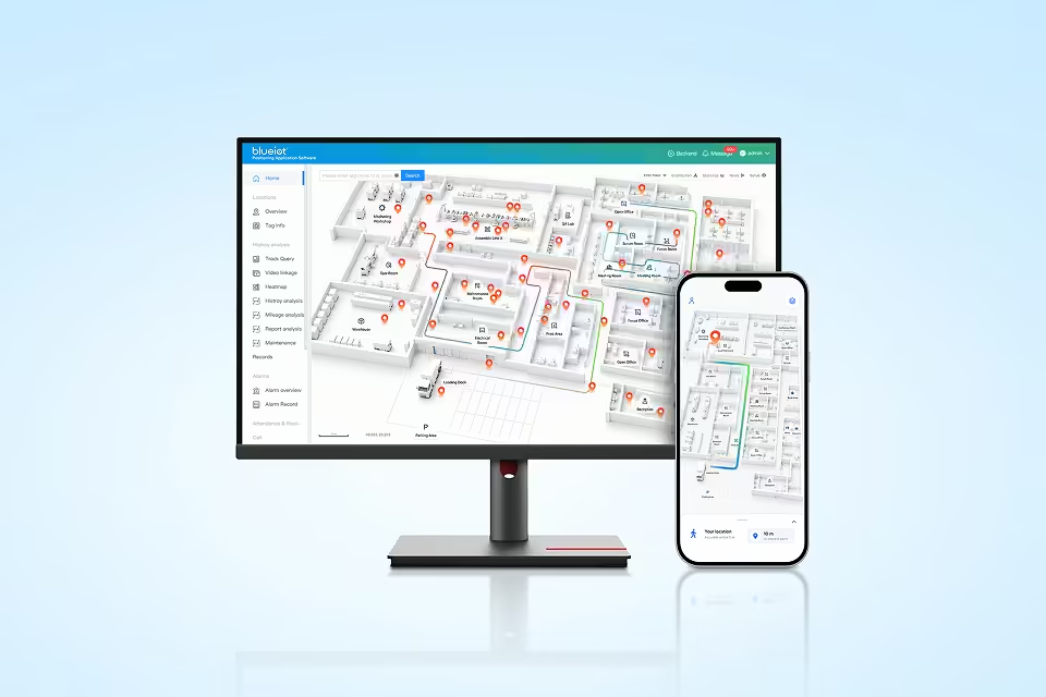
Positioning Engine
Open API software that fuses tag angle data into real-time coordinates and powers analytics, geofencing, and RTLS workflows.
Learn MoreTry a Development Kit Now
Blueiot provides cost-effective real-time location system (RTLS) products for any industry. Everything you need to start building, in one kit.
Start with a Demo!
Order Now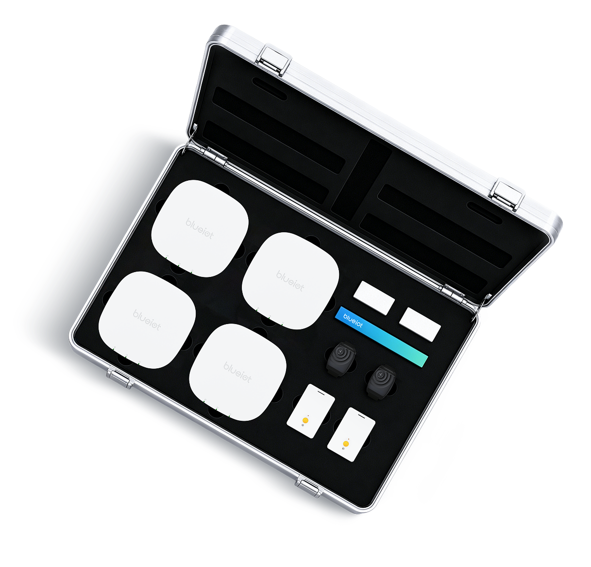
IoT Together