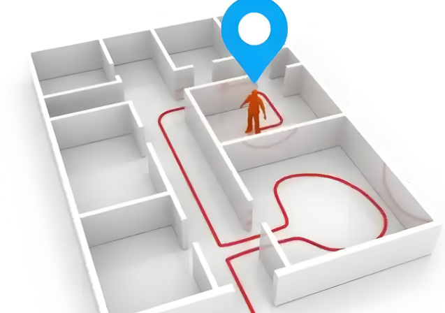
Indoor environments like large shopping malls, airports, and hospitals often struggle to find their destination quickly due to the complex spaces. The emergence of indoor navigation systems has effectively addressed this challenge, providing precise guidance for people's movements within indoor spaces. So, what are the core components of indoor navigation?

Positioning Module
The positioning module is the cornerstone of indoor navigation systems, responsible for determining the user's precise location within indoor environments. Unlike outdoor navigation, which primarily relies on GPS, indoor environments are complex, and signals are susceptible to obstruction and interference. Therefore, a combination of multiple positioning technologies is required.
Bluetooth beacon positioning: Bluetooth beacons are deployed at key locations indoors. These beacons periodically transmit Bluetooth signals containing their unique identifiers and signal strength. Upon receiving the signals, a user's mobile device (such as a phone) measures the signal strength and, based on a pre-established model of signal strength and distance, estimates the distance to the beacon and thus determines its own location. Bluetooth beacon positioning offers the advantages of low cost and easy deployment, making it widely used in places like shopping malls and museums.
Wi-Fi positioning: Positioning is achieved by leveraging existing indoor Wi-Fi access points. By measuring parameters such as signal strength and time difference of arrival between a mobile device and multiple Wi-Fi access points, triangulation or multilateration algorithms are used to calculate the device's location. The advantage of Wi-Fi positioning is that it doesn't require extensive hardware deployment, but positioning accuracy may be affected by Wi-Fi signal coverage and interference.
Ultra-Wideband (UWB) positioning: UWB technology transmits signals by sending and receiving extremely narrow pulses in the nanosecond or even picosecond range, resulting in extremely high temporal resolution and interference immunity. It can achieve centimeter-level positioning accuracy in indoor environments and is suitable for scenarios requiring extremely high positioning accuracy, such as material handling in factories and medical equipment tracking in hospitals. However, UWB equipment is relatively expensive.
Map Data Module
The map data module provides the spatial information foundation for indoor navigation, detailing the layout and features of the indoor environment.
Building structure data: This includes the location, size, and shape of building elements such as walls, doors and windows, stairways, and elevators. This data can be obtained through architectural drawings, 3D laser scanning, and other methods. Accurate building structure data is the foundation for building indoor maps, helping users understand the physical boundaries and navigable paths within a building.
Functional Area Data: This maps the location and boundaries of each functional area, such as shops, restaurants, and restrooms in a shopping mall, or departments and examination rooms in a hospital. It also records relevant information about each functional area, such as the store name, business hours, and product types, providing users with richer navigation information.
Path Data: This maps feasible indoor paths, including corridors and passageways. Path data must consider actual traffic conditions, such as whether pedestrians are allowed and whether there are obstacles. Through rational path planning, users are provided with the optimal navigation route.
Path Planning Module
The path planning module plans an optimal path for the user based on the user's starting and destination locations, combined with map data.
Algorithm Selection: Common path planning algorithms include Dijkstra's algorithm and A's algorithm. The Dijkstra algorithm finds the shortest path from a starting point to all other nodes and is suitable for simple path planning scenarios. Algorithm A builds on the Dijkstra algorithm by introducing a heuristic function. By estimating the distance from the current node to the target node, it prioritizes nodes that are more likely to be closer to the target, thereby improving path planning efficiency. This is particularly suitable for indoor environments with a large number of nodes.
Multi-factor considerations: In actual path planning, in addition to distance, other factors must be considered, such as travel time, whether a route passes through congested areas, and whether a route avoids construction sites. For example, in a shopping mall, users may prefer a route with less traffic and a comfortable environment. In a hospital, the route must be able to meet the needs of rapid passage in emergency situations.
Dynamic Adjustment: Indoor environments may change, such as temporary closures of certain areas or store relocations. The path planning module must be able to dynamically adjust and replan routes based on these environmental changes, ensuring that users always have a viable navigation solution.
User Interface Module
The user interface module serves as the interface between the user and the indoor navigation system and directly impacts the user experience. Display Method: Two-dimensional maps, three-dimensional maps, or augmented reality (AR) can be used. Two-dimensional maps are concise and clear, suitable for quickly viewing locations and routes. Three-dimensional maps provide a more realistic sense of space, allowing users to better understand the indoor environment. AR technology can overlay navigation information on the real scene, creating a more intuitive navigation experience.
Ease of Use: The user interface should be simple and easy to use, allowing users to easily perform various operations, such as entering a target location, viewing route details, and switching map views. Different user habits and device types should also be considered to ensure smooth operation on various devices.
Feedback: Navigation information such as current location, remaining distance, and estimated time of arrival (ETA) should be provided to users in a timely manner. Voice prompts and vibration feedback can also be used to provide users with more personalized navigation services, eliminating the need to frequently check their phones while walking.
Indoor navigation systems consist of four core components: positioning module, map data module, route planning module, and user interface module. These modules work together to provide users with accurate and convenient indoor navigation services. With the continuous development of technology, indoor navigation systems will continue to be improved and optimized, bringing more convenience to people's lives.